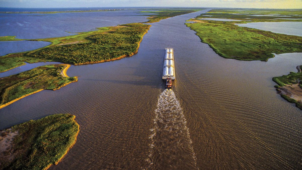
The Intracoastal Waterway (ICW) is a roughly 3,000-mile network of rivers, bays, sounds, and dredged channels that lets boats travel the Atlantic and Gulf coasts without heading into open ocean.
Look at a map of the East Coast and the Intracoastal Waterway. It looks like one long, straight canal on a map, but it isn’t. The route mixes natural waterways with channels dredged over more than a century, starting with private companies long before the federal government stepped in
Private companies started the work long before the federal government stepped in, and Florida played one of the biggest roles in how the system came together.
Understanding the Intracoastal Waterway history means following how ownership passed from private canal companies to the U.S. Army Corps of Engineers. Let’s start with what the waterway is before getting into when and how it was built.
What Is the Intracoastal Waterway?
The Intracoastal Waterway, usually shortened to ICW, is a network of connected waterways along the Atlantic and Gulf coasts of the United States. It is not a single artificial canal from end to end. The full route, as mapped out on Wikipedia’s Intracoastal Waterway page, runs from Massachusetts down to Brownsville, Texas.
It links rivers, sounds, bays, lagoons, and natural inlets, filling the gaps between them with dredged cuts where no natural passage existed. The National Ocean Service describes it as a protected route that boats can use instead of heading into open ocean.
A few basics worth knowing:
- Spans roughly three thousand miles from Massachusetts down around Florida and on to Texas
- Combines natural and human-made sections rather than being one continuous ditch
- Was designed to keep boat traffic sheltered from rough offshore water
- Its name refers to its position, running within or near the coast rather than out in open water
- Frequently called “the Ditch” by boaters who travel the same stretches season after season
Think of it less like a canal and more like a chain, where each link was added at a different time by a different group of people.
About Atlantic and Gulf Intracoastal Waterways
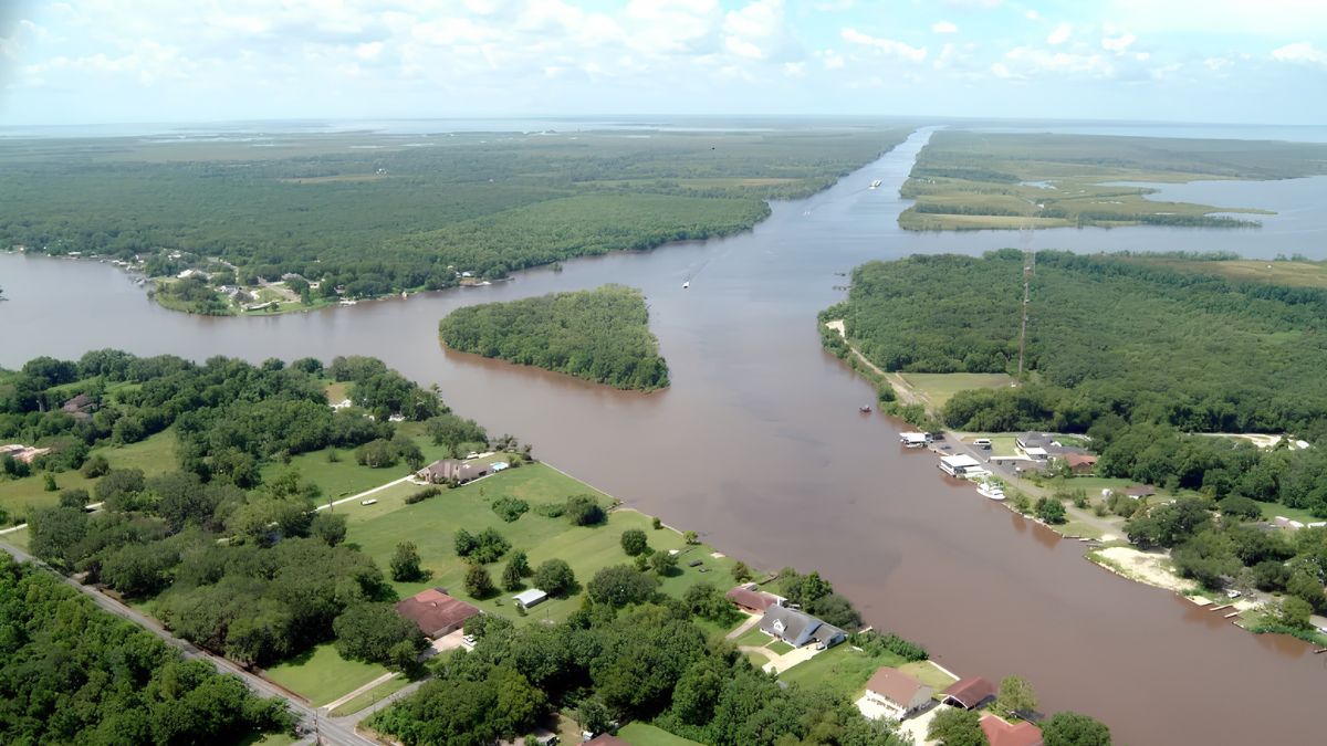
Image Credits – wikimedia.org
The Atlantic Intracoastal Waterway runs along the eastern seaboard, with federally maintained sections extending from Virginia down through Florida. It passes through well-known boating areas in the Carolinas, Georgia, and Florida.
The Gulf Intracoastal Waterway picks up on Florida’s west coast and continues toward Texas. It gets less attention in casual conversation, but it carries heavy commercial barge traffic, including fuel, chemicals, and grain.
A few things worth knowing about how these two sections relate:
- They were not built as one connected project
- Florida sits in the middle of both
- Total mileage figures vary between sources depending on which stretches get counted
Together, these two stretches form one route down and around the coast, though as the history below shows, they were never physically joined into a single unbroken channel. Federal standards call for the ICW to be maintained at a 12-foot depth along most of its length, though funding gaps mean several sections run shallower today.
Why Was the Intracoastal Waterway Created?
Before this existed, coastal travel meant either going out into the open ocean or relying on whatever natural rivers and inlets lined up. Neither option was reliable.
Storms, currents, and rough seas made ocean travel risky for smaller vessels, and natural waterways didn’t always connect where people needed them to. Cape Hatteras, off North Carolina’s Outer Banks, was one of the worst stretches.
Sailors nicknamed the waters there the Graveyard of the Atlantic, and avoiding that kind of exposure was a major reason coastal shippers kept pushing for a protected inland route.
A connected inland route solved several problems at once:
- Safer travel that avoided open ocean conditions
- Easier movement of freight between small coastal towns
- Better connections between rivers, ports, and inland markets
- Strategic value for moving goods and troops during wartime
Coastal communities had used natural waterways for generations. The real project was closing the gaps so a boat could travel hundreds of miles without repeatedly returning to open sea.
Where the Intracoastal Waterway Idea Began
The roots of the Intracoastal Waterway go back well before there was a national plan for it. One of its oldest sections, the Dismal Swamp Canal, was built between Virginia and North Carolina in the late 1700s and early 1800s, with enslaved labor playing a major role in its construction.
A broader coastal route entered federal planning in 1808, when Treasury Secretary Albert Gallatin proposed a national system of roads and canals. His 1808 canal plan included inland waterways along the Atlantic Coast.
Federal involvement grew after the War of 1812. The General Survey Act of 1824 then authorized surveys for nationally important roads and canals, giving Army engineers a larger role in projects that eventually helped shape the modern waterway.
When Was the Intracoastal Waterway Built?
No single year marks the ICW’s completion. What exists today came together through private canals, state involvement, and federal navigation work spread across more than a century.
|
Period |
What Changed |
|---|---|
|
1793 to 1805 |
The Dismal Swamp Canal is dug through the Virginia-North Carolina border, the oldest piece of what becomes the ICW |
|
1808 to 1824 |
Gallatin’s report and the General Survey Act establish federal interest in connected waterways |
|
1880s to early 1900s |
Private canal companies dig and connect sections, including Florida’s east coast route |
|
1909 |
Congress authorizes the first federal surveys of a connected Atlantic and Gulf waterway route |
|
1917 to 1930s |
Congress consolidates the regional projects, and the federal government buys and widens existing private canals, including Florida’s |
|
1936 |
The Atlantic ICW opens as a continuous channel from Norfolk, Virginia, to Fernandina Beach, Florida |
|
Late 1940s |
The Gulf ICW substantially reaches Brownsville, Texas, but the planned canal link through the Florida Panhandle is never built |
The Florida Panhandle link that would have joined the Atlantic and Gulf sections was never dredged, so today’s ICW is technically two separate systems, connected only by open Gulf water and the shallow Okeechobee Waterway.
The Albemarle and Chesapeake Canal shows the same pattern: built privately in the nineteenth century, later folded into the federal route, much like Florida’s own canal.
Who Built the Intracoastal Waterway?
No single person or organization built the Intracoastal Waterway. Credit spreads across several groups that worked in different eras, often without coordinating with each other at all.
- Early planners: proposed the broader concept of a connected national canal system, starting with Gallatin’s 1808 report
- Private companies: did the actual digging in the nineteenth century, particularly in Florida, where the Florida Coast Line Canal and Transportation Company built most of the original route
- State and local governments: supplied land grants, financing, and rights of way that made private construction possible, and later formed bodies like the Florida Inland Navigation District to purchase private canals for federal transfer
- Congress: authorized federal navigation projects and funding once private routes proved their value
- U.S. Army Corps of Engineers: surveyed, purchased, widened, and continues to maintain most of the federally controlled sections today
Put simply, the waterway grew through teamwork across time, not one builder’s plan.
How the Florida Intracoastal Waterway Developed
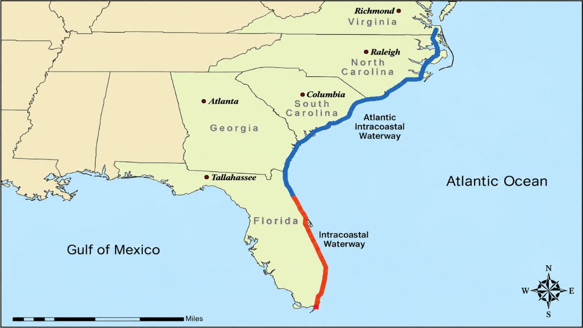
Image Credits – mapsofflorida.net
Florida’s version of this story starts in 1881, when a group of St. Augustine residents organized the Florida Coast Line Canal and Transportation Company. The state authorized the company to dredge canals connecting existing lakes, rivers, and lagoons down the Atlantic side of the peninsula.
As an incentive, Florida offered land grants of thousands of acres for every mile completed. The Palm Beach County archive notes that the state turned to this arrangement after federal financing for the project fell through.
The work moved south in stages:
- Crews connected the Matanzas and Halifax rivers with a difficult dredged cut starting in 1882
- Railroad developer Henry Flagler invested in the company in 1892 and became its president the following year, using the arrangement to support his own railway expansion south
- Construction reached Jupiter and pushed on toward Lake Worth through the early 1890s
- The company earned over a million acres of state land for completing 268 miles of canal by 1912
The private canal operated as a tollway for decades, but it eventually became too important to leave in private hands. Congress authorized a federal takeover project in 1927, and Florida created the Florida Inland Navigation District (FIND) that same year to act as the local sponsor.
FIND issued bonds to purchase the aging canal from its private owner, then deeded it to the federal government in 1929, at which point the U.S. Army Corps of Engineers took over operation and maintenance.
Federal crews then widened and deepened sections that had been narrow under private management. What had started as a privately run tollway became a public channel maintained with federal funds.
How Trade and War Changed the Waterway
Trade and war both pushed the waterway forward. Each one made a safe, connected route feel less like a convenience and more like a necessity.
- Commercial growth: As coastal towns grew, so did pressure for channels that could reliably carry barges and freight rather than just small passenger boats.
- World War I: Moving bulk cargo by barge became more valuable as the war strained other forms of transportation, giving inland waterways new importance.
- World War II: German submarines operating off the Atlantic Coast made protected inland routes genuinely necessary, since ships hugging the open coast were exposed and easy targets. Coastal shippers moved inside the ICW specifically to avoid that threat.
- After the wars: Commercial and recreational boat traffic kept growing, and existing sections were widened and deepened to accommodate larger vessels.
These pressures pushed different stretches of the waterway toward federal ownership at different speeds. That is part of why the system still looks uneven today, with some sections wide and well maintained and others narrower and closer to their original dimensions.
What the Intracoastal Waterway Is Used for Today
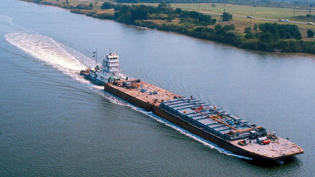
Image Credits – txdot.gov
The modern route serves a mix of purposes that would have looked familiar to the people who built its earliest sections, just at a much larger scale.
Today it supports:
- Commercial barges moving petroleum, chemicals, and grain
- Access routes into major ports
- Recreational boat traffic that shifts north and south with the seasons. Paddlers interested in these sheltered coastal waters can also check out kayaking in Florida for more places to get on the water.
Federal agencies and local navigation districts still dredge and maintain sections of the channel, since sand and silt naturally fill in dredged cuts over time. If you plan to operate a motorized boat along the Florida section, it is also worth checking if you need a boating license in Florida before heading out.
Modern charts make the route look continuous, but the waterway underneath still follows the same mixture of natural passages and engineered cuts that earlier generations put together piece by piece.
Wrapping Up
The Intracoastal Waterway never started as one canal, planned from end to end and built in a single push. Natural rivers and lagoons formed most of its path, and the connected system wasn’t complete until the Gulf section reached Texas in 1949.
Private companies, state governments, Congress, and the Army Corps of Engineers each added their own piece over more than a century, with Florida showing that shift from private tollway to federal project more clearly than anywhere else.
The route people use today still carries that layered history, even if the chart makes it look like one continuous line.
Common Questions About the Intracoastal Waterway
Is the Intracoastal Waterway Man-Made?
Only partly. Natural bays, rivers, lagoons, and inlets make up a large share of the total route, while dredged channels connect the sections that were not naturally linked.
How Long Is the Intracoastal Waterway?
The combined Atlantic and Gulf system runs roughly three thousand miles, though the exact figure depends on which connected sections get included in the count.
Where Does the Intracoastal Waterway Start and End?
Officially, the Atlantic Intracoastal Waterway begins near Norfolk, Virginia, and runs south to Key West, Florida, while the Gulf Intracoastal Waterway continues from Florida’s west coast to Brownsville, Texas. Broader descriptions extend the route north to Boston.
What Does Intracoastal Mean?
Intracoastal describes a route that stays close to or within the coastline, moving through sheltered water rather than out in the open ocean.